Our event series “Maptime” is all about maps in every possible form! This time, the focus is on projects that can be experienced physically, exploring how spatial data can not only be visualized but also felt, experienced, and shaped.
From textile cartographies and robot-assisted data embroidery to the Berliner Platte, which transforms traffic data into an interactive installation: at this Maptime, artists, designers, and developers demonstrate how maps can be reimagined through materiality, craftsmanship and technology.
What can you expect?
Data Fabrics – Data visualization meets craft and robotics
Students and lecturers from the Design Department at the University of Applied Sciences Potsdam explore the boundaries of data visualization in the Data Fabrics project, making it tangible through the traditional craft technique of tufting. Robotic arms automate this originally manual process, creating an innovative interface between robotics and craftsmanship. The resulting textile data visualizations focus on the socio-political situation in Brandenburg and make spatial datasets accessible in a new, tactile way. Some of the works will be on display on site.
Sensing Data
Mark-Jan Bludau (Research Associate at UCLAB, FH Potsdam) presents works from the Sensing Data course at Weißensee Academy of Art Berlin, which he led as a visiting professor. The course explored how information can be encoded in materials. What happens when we don’t just read information visually, but experience it through other senses?
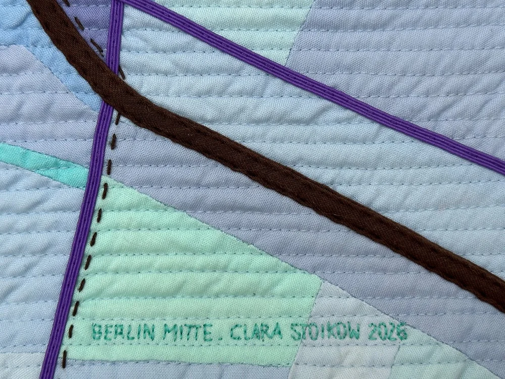
Map Quilts
Clara Stoikow is an architect, maker, and quilter—she creates textile artworks composed of multiple layers of fabric, decorated with patterns or designs. Clara will share her experiences creating quilts, particularly those that translate maps into fabric. Her aim is to create something tangible that is both aesthetically appealing and practically useful.
Berliner Platte
The prototyping team from CityLAB Berlin presents its latest physical project. This interactive installation shows how traffic in Berlin is composed. With the Berliner Platte, the mix of transportation becomes playfully tangible. Traffic blocks representing cars, bicycles, trucks, and pedestrians are placed on a rotating platform. Based on real-time traffic data, a matching Berlin street is identified. The result is enriched with additional open data—such as noise levels, air quality, and the prevalence of bike streets—providing a comprehensive insight into each street. The installation can be tested on site.
Come by and discover how data becomes tangible.
The event will be held in English. Pizza and drinks will be provided.